Nepal Earthquake Today
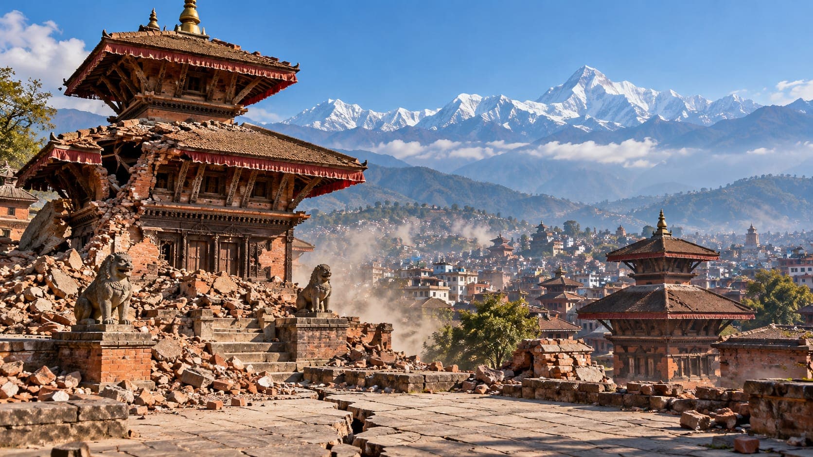
Nepal lies across one of the most active collision zones on Earth, where the Indian plate pushes into Asia and builds the Himalaya. Small earthquakes are recorded there often, and the 2015 Gorkha earthquake showed how devastating a large one can be.
Because this is a reference article, it does not list today's earthquakes. It explains where to find verified, up-to-date information for Nepal, how to interpret what you find, and what makes earthquakes in the Himalaya especially hazardous.
Quick answer
To check for a Nepal earthquake today, look first at Nepal's National Earthquake Monitoring and Research Center (NEMRC), the official national source, which reports location, local time and magnitude. For international coverage, check the USGS, EMSC or the EQRadar live map of USGS data. Small differences in magnitude between sources are normal. If you felt strong shaking, expect aftershocks and watch for landslides on steep slopes.
Open the live map of NepalWhere to find verified information
The National Earthquake Monitoring and Research Center, part of Nepal's Department of Mines and Geology, operates the national seismic network and posts recent earthquakes on its website. Its reports use Nepal time and often name the nearest district or town, which makes them easy to relate to where you are. For rescue, shelter and road information, follow Nepal's government authorities and your local municipality.
International agencies add useful context. The U.S. Geological Survey (USGS) and the European-Mediterranean Seismological Centre (EMSC) locate moderate and larger earthquakes in Nepal, and for significant events USGS may publish a ShakeMap estimating where shaking was strongest. You can open the EQRadar live map of Nepal to see USGS-reported events in the region, and use the ShakeMap viewer for larger ones.
How to read a Nepal earthquake report
Nepal Standard Time is UTC+5:45, an unusual offset. USGS and EMSC list times in UTC, so an event at 06:00 UTC happened at 11:45 in Kathmandu. When comparing sources, convert carefully before deciding whether two reports describe the same earthquake.
NEMRC often reports a local Magnitude, while USGS commonly reports a body-wave magnitude for moderate events and moment magnitude for larger ones. These can differ by a few tenths. The location can also differ slightly, because each agency uses different stations. Small earthquakes in remote mountain areas may appear only in the national catalog, since international networks have fewer nearby stations. Automatic first reports may be revised after review.
Why Nepal has earthquakes
India is moving northward into Asia at several centimeters per year, and roughly a third to a half of that convergence is taken up across the Himalaya. Beneath Nepal, the Indian plate slides under the Himalaya along a gently sloping Fault known as the Main Himalayan Thrust. Most of the time the fault is locked, so strain builds up for centuries and is released in large earthquakes.
Several faults reach the surface along the length of the country, including the Main Frontal Thrust near the southern edge of the hills. Large earthquakes can occur anywhere along the arc, from the far west to the east. The 2015 Gorkha earthquake ruptured part of the fault beneath and east of Kathmandu but did not break all the way to the surface, so scientists consider other segments of the Himalaya still capable of large earthquakes. Read more in how plates move.
Notable earthquakes in Nepal
On April 25, 2015, a magnitude 7.8 earthquake centered in the Gorkha district struck central Nepal. Nearly 9,000 people died, and hundreds of thousands of homes were damaged or destroyed, along with many historic monuments in the Kathmandu Valley. A magnitude 7.3 aftershock followed on May 12. Our article on the 2015 Nepal earthquake covers it in detail.
| Year | Earthquake | Magnitude | Notes |
|---|---|---|---|
| 1934 | Bihar–Nepal earthquake | about 8 | Severe damage in Kathmandu and northern India |
| 1988 | Udayapur earthquake | about 6.8–6.9 | Eastern Nepal near the Indian border |
| 2015 | Gorkha earthquake | about 7.8 | Central Nepal, including the Kathmandu Valley |
| 2015 | Dolakha aftershock | about 7.3 | Struck on May 12, east of the main rupture |
| 2023 | Jajarkot earthquake | about 5.7 | Moderate but damaging in western Nepal |
Landslides, soft soils and other hazards
In Nepal, shaking is only part of the danger. Steep slopes mean that a strong earthquake can trigger thousands of landslides, blocking roads and rivers and cutting off villages. The 2015 earthquake set off many landslides, and loosened slopes can fail again during the following monsoon. If you live or travel in the hills, stay away from steep slopes, cliffs and riverbanks after strong shaking.
The Kathmandu Valley sits on soft sediments left by an ancient lake. Soft ground can amplify and lengthen shaking compared with nearby rock, which affects how buildings in the valley respond. Older brick and stone buildings with weak mortar are the most vulnerable, so building safety and retrofitting are major parts of Nepal's earthquake preparedness. Nepal marks a national Earthquake Safety Day each year around mid-January, near the anniversary of the 1934 earthquake.
If you felt an earthquake in Nepal
During shaking, Drop, Cover and Hold On, and protect your head from falling bricks and objects. If you are outdoors, move away from buildings, walls and slopes. After the shaking stops, check for injuries, leave damaged buildings carefully and avoid narrow lanes between tall buildings. Expect aftershocks; after a large earthquake they can continue for weeks or months and may include strong ones. Check NEMRC for event details and follow official guidance for shelter and travel. Our guide on what to do after an earthquake has more detail.
Frequently asked questions
Why does the Nepal earthquake time look wrong on international sites?
International sites such as USGS and EMSC usually show times in UTC. Nepal is UTC+5:45, so you need to add five hours and forty-five minutes to get Nepal time.
Is Kathmandu at risk of another large earthquake?
Yes. The Main Himalayan Thrust beneath Nepal can produce large earthquakes, and the 2015 earthquake did not release strain along the whole arc. No one can predict when the next one will happen, so preparedness and safer buildings are the practical response.
Why are landslides such a big problem after earthquakes in Nepal?
Nepal's mountains have steep, often weathered slopes. Strong shaking can make them fail immediately, and slopes cracked by an earthquake can fail later during heavy monsoon rain.
Does a small earthquake mean a big one is coming in Nepal?
Usually not. Most small earthquakes are not followed by larger ones. Occasionally a small event turns out to be a foreshock, but that can only be known afterward, so the best response is steady preparation rather than alarm.
Key takeaway
For a Nepal earthquake today, check NEMRC first, then USGS, EMSC or the EQRadar live map for context, remembering that Nepal time is UTC+5:45. The Himalaya can produce very large earthquakes, and landslides and fragile buildings are major hazards, so follow official guidance after any strong shaking.
Sources
- National Earthquake Monitoring and Research Center — Department of Mines and Geology, Nepal
- Latest Earthquakes Map — U.S. Geological Survey
- European-Mediterranean Seismological Centre — EMSC
- Earthquake Hazards Program — U.S. Geological Survey