2015 Nepal Earthquake
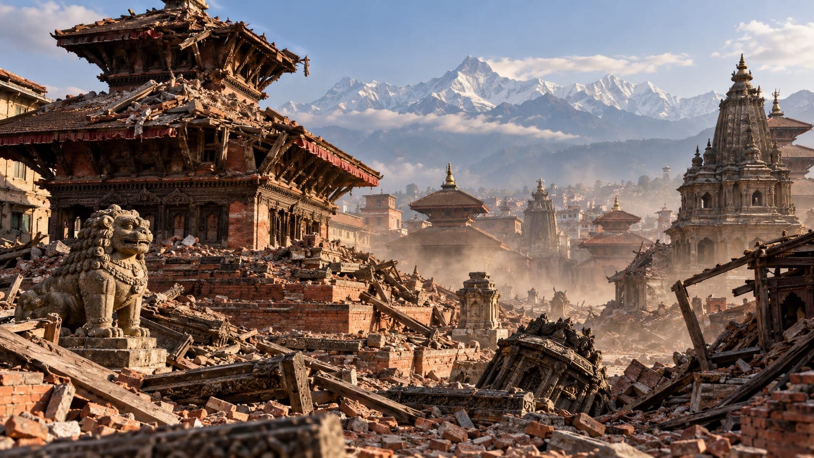
On April 25, 2015, a magnitude 7.8 earthquake struck central Nepal. Known as the Gorkha earthquake, after the district near its epicenter, it caused enormous loss of life and destroyed or damaged homes, schools and centuries-old monuments across the country. Weeks later, a powerful aftershock struck again.
This article explains what happened, why the Himalaya produces such large earthquakes and what the disaster showed about earthquake risk in mountain regions.
Quick answer
The 2015 Nepal (Gorkha) earthquake struck on April 25, 2015, with a magnitude of 7.8. It occurred on the Main Himalayan Thrust, the fault where the Indian Plate pushes beneath Asia. Nearly 9,000 people died, mostly in Nepal. Shaking damaged historic sites in the Kathmandu Valley and triggered landslides and an avalanche at Mount Everest. A magnitude 7.3 aftershock followed on May 12, 2015.
Central NepalWhat happened on April 25, 2015
The earthquake struck shortly before noon local time. Its Epicentre was in the Gorkha District, northwest of the capital, Kathmandu. The rupture started there and spread eastward for well over 100 km, passing beneath the Kathmandu Valley. The Hypocentre (focus) was shallow, which helped make the shaking strong at the surface.
Nearly 9,000 people lost their lives, most of them in Nepal, with additional deaths in neighboring India, China and Bangladesh. Many thousands more were injured, and a very large number of homes were destroyed or damaged, especially in rural hill districts where traditional stone and mud houses are common. It struck on a Saturday, the weekly day off in Nepal, when schools were closed; many observers have noted that this likely spared many children.
Why the Himalaya has large earthquakes
The Himalaya exists because the Indian Plate is pushing northward into the Eurasian Plate, moving roughly 4 to 5 cm per year relative to it. Much of this motion is taken up on a large, gently sloping fault called the Main Himalayan Thrust, where India slides beneath the mountains.
For long periods this Fault stays locked, and strain builds up. When it slips suddenly, the result can be a large thrust earthquake like the one in 2015. Similar earthquakes have struck the region in the past, including a destructive earthquake in 1934. Our article on what tectonic plates are explains plate collisions in more detail.
Kathmandu and its heritage sites
The Kathmandu Valley sits on thick layers of soft lake and river sediment, which can amplify certain kinds of shaking. Many older brick buildings and temples in the valley's historic squares were damaged or collapsed, including structures in the Durbar Squares of Kathmandu, Patan and Bhaktapur, which are part of a UNESCO World Heritage site. The historic Dharahara tower in Kathmandu also collapsed.
Some modern buildings in the city were also damaged, while others performed reasonably well. As in many earthquakes, older unreinforced masonry and poorly built structures suffered most.
Landslides and the Everest avalanche
In the steep mountains, the shaking triggered a very large number of landslides, which blocked roads and rivers and buried villages. Damaged roads made it difficult for rescuers and supplies to reach remote communities for days or weeks.
On Mount Everest, the earthquake set off an avalanche that swept through Everest Base Camp, killing climbers and support staff. In the Langtang Valley north of Kathmandu, a massive avalanche and landslide buried much of the village of Langtang.
The May 12 aftershock
As expected after a large earthquake, many aftershocks followed. The largest, magnitude 7.3, struck on May 12, 2015, east of the main rupture. It caused further deaths and damage, brought down buildings already weakened in April and set off more landslides. Its timing, more than two weeks later, showed why people should stay out of damaged buildings even after the first days pass.
Our article on how long aftershocks last explains how aftershock activity typically decreases over time.
Lessons from the Gorkha earthquake
The 2015 earthquake underlined several lessons that apply to mountain regions around the world:
- Rural homes built of stone and mud mortar are very vulnerable, and safer, affordable construction methods save lives.
- Landslides can cut off communities for long periods, so local supplies and preparedness matter.
- Large aftershocks can strike weeks later, so damaged buildings should be inspected before reuse.
- Historic structures need careful strengthening to survive future earthquakes.
Following earthquakes in Nepal today
Nepal continues to experience earthquakes, and scientists consider parts of the Himalaya capable of producing large earthquakes in the future. Nepal's National Earthquake Monitoring and Research Center reports local earthquakes. You can see recent USGS-reported earthquakes in the region on the EQRadar live map and read more in our article on Nepal earthquakes today.
Frequently asked questions
What magnitude was the 2015 Nepal earthquake?
The main earthquake on April 25, 2015, was magnitude 7.8. The largest aftershock, on May 12, 2015, was magnitude 7.3.
How many people died in the 2015 Nepal earthquake?
Nearly 9,000 people died, most of them in Nepal. The May 12 aftershock caused additional deaths.
Why is it called the Gorkha earthquake?
It is named after the Gorkha District of central Nepal, where the epicenter was located, northwest of Kathmandu.
Was the 2015 Nepal earthquake felt in other countries?
Yes. Shaking was felt widely across northern India, as well as in Bangladesh, Bhutan and southern Tibet in China, and some deaths occurred outside Nepal. Large Himalayan earthquakes are often felt hundreds of kilometers away.
Key takeaway
The 2015 Gorkha earthquake was a magnitude 7.8 rupture of the Main Himalayan Thrust that killed nearly 9,000 people. Vulnerable buildings, landslides and a large aftershock weeks later all shaped the disaster, offering lessons for mountain regions worldwide.
Sources
- National Earthquake Monitoring and Research Center — Department of Mines and Geology, Nepal
- Earthquake Hazards Program — U.S. Geological Survey
- Lists, Maps, and Statistics — U.S. Geological Survey