India Earthquake Today
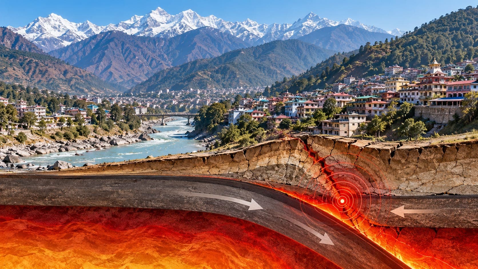
India is a vast country with very different earthquake hazards from region to region. The Himalaya and northeast India are among the most active areas on Earth, while large parts of peninsular India shake only occasionally. Delhi and other northern cities often feel small earthquakes from the Himalaya and nearby areas.
This page is a reference article and does not report today's earthquakes. It explains where to find verified information, how to read the reports, and which parts of India face the greatest risk.
Quick answer
To check for an India earthquake today, go first to the National Center for Seismology (NCS) under the Ministry of Earth Sciences, India's official source for earthquake reports. For international context, use the USGS, EMSC or the EQRadar live map of USGS data. NCS gives times in Indian Standard Time (UTC+5:30), and its magnitude may differ slightly from international values. For tsunami warnings on Indian coasts, follow INCOIS.
Open the live map of IndiaWhere to check earthquakes in India
The National Center for Seismology operates India's national seismological network and publishes recent earthquakes with their location, depth, magnitude and time. Its reports often describe the location as a distance from a known town, which is useful when you are trying to work out whether the shaking you felt came from nearby or far away. For relief and safety instructions, follow the National Disaster Management Authority and your state and district authorities.
Tsunami warnings for Indian coasts come from the Indian Tsunami Early Warning Centre at INCOIS (Indian National Centre for Ocean Information Services) in Hyderabad. Internationally, the U.S. Geological Survey (USGS) and the European-Mediterranean Seismological Centre (EMSC) report moderate and larger earthquakes in and around India. On EQRadar you can open the live map of India to see USGS-reported events and use the history view to search past earthquakes in a region.
How to read an Indian earthquake report
India uses Indian Standard Time, UTC+5:30, all year. USGS and EMSC list times in UTC, so an earthquake at 08:30 UTC happened at 14:00 IST. NCS often reports a local Magnitude for small events, while USGS uses other magnitude types, so the numbers may differ by a few tenths. Small earthquakes may appear only in the NCS catalog.
Location matters a lot. Many earthquakes felt in Delhi or northern India actually start in the Hindu Kush region of Afghanistan, where earthquakes are often around 200 kilometers deep. Deep earthquakes like these can be felt over a very large area while causing little damage. A shallow earthquake of the same magnitude closer to home would shake much harder. Our lesson on why depth matters explains why.
Why India has earthquakes
The Indian plate is moving north into Asia at several centimeters per year. Along the Himalaya, this collision is taken up by thrust faults, where India slides beneath the mountains. Strain builds for long periods and is released in large earthquakes along the arc from Jammu and Kashmir through Himachal Pradesh, Uttarakhand, Nepal, Sikkim and into Arunachal Pradesh.
Northeast India is especially active, because the region is caught between the Himalayan collision and the Indo-Burman ranges to the east. Farther south, the Andaman and Nicobar Islands sit above a Subduction zone that ruptured in 2004. Even the interior of the plate is not entirely quiet: the Kutch region of Gujarat and parts of peninsular India have had damaging earthquakes on older faults. Read more about the setting in how plates move.
Notable earthquakes affecting India
On January 26, 2001, a magnitude 7.7 earthquake struck the Kutch region of Gujarat during Republic Day morning. It destroyed large parts of Bhuj and many other towns and killed many thousands of people. The 1950 Assam–Tibet earthquake, about magnitude 8.6, is among the largest continental earthquakes ever recorded.
| Year | Earthquake | Magnitude | Notes |
|---|---|---|---|
| 1897 | Shillong Plateau (Assam) | about 8 | Major earthquake in northeast India |
| 1950 | Assam–Tibet | about 8.6 | Massive landslides and river blockages |
| 1993 | Latur (Killari), Maharashtra | about 6.2 | Shallow earthquake in peninsular India |
| 2001 | Bhuj (Gujarat) | about 7.7 | Heavy damage across Kutch and Gujarat |
| 2004 | Sumatra–Andaman | about 9.1 | Tsunami struck the Andaman and Nicobar Islands and India's east coast |
India's seismic zones and local hazards
The Bureau of Indian Standards (BIS) publishes a seismic zone map as part of its building code for earthquake-resistant design (IS 1893). For many years it has divided the country into zones II to V, with zone V, the highest, covering the northeast, parts of the Himalaya, the Kutch region and the Andaman and Nicobar Islands. Delhi has been placed in zone IV. Standards are revised from time to time, so check the current edition for building decisions.
Beyond shaking, landslides are a major hazard in the Himalayan states and the northeast, especially during the monsoon. Soft river sediments in the Indo-Gangetic plains can amplify shaking and, where wet and loose, undergo Liquefaction. The east coast and island territories face Tsunami risk from the Andaman–Sumatra subduction zone, and the Makran region to the west is also a possible source for the Arabian Sea.
If you felt an earthquake in India
Drop, Cover and Hold On during shaking, and stay away from windows, heavy furniture and outer walls. Do not crowd onto stairways or into elevators. When the shaking stops, check for injuries and damage, and leave if the building is cracked or unsafe. On the coast or in the islands, move to high ground after strong or long shaking and follow INCOIS and local authorities. Then check NCS for details and expect possible aftershocks. See our earthquake safety tips for more.
Frequently asked questions
Why do people in Delhi feel earthquakes that happened in Afghanistan?
Many of these earthquakes come from the Hindu Kush region, where they are often around 200 kilometers deep. Deep earthquakes spread their shaking over a wide area, so they can be felt hundreds of kilometers away, usually without causing damage in Delhi.
Which seismic zone is my city in?
The BIS seismic zone map in the IS 1893 standard places regions in zones from II to V, with V being the highest hazard. Delhi has been in zone IV. Because the map is revised periodically, check the current BIS edition or your state disaster authority for up-to-date information.
Who issues tsunami warnings in India?
The Indian Tsunami Early Warning Centre at INCOIS in Hyderabad issues tsunami bulletins for Indian coasts and islands. Local authorities manage evacuation. Strong or long shaking on the coast is itself a reason to move to high ground.
Why does the NCS magnitude differ from the USGS magnitude?
NCS and USGS use different stations and often different magnitude types. A difference of a few tenths is normal, and early values can be revised. NCS is India's official source.
Key takeaway
For an India earthquake today, check the National Center for Seismology first, use INCOIS for tsunami warnings, and add USGS, EMSC or the EQRadar live map for international context. Hazard varies widely across India, so know your seismic zone and local risks such as landslides and liquefaction.
Sources
- National Center for Seismology — Ministry of Earth Sciences, Government of India
- Indian National Centre for Ocean Information Services (INCOIS) — Ministry of Earth Sciences, Government of India
- Latest Earthquakes Map — U.S. Geological Survey
- European-Mediterranean Seismological Centre — EMSC