Earthquake Fault Lines in California
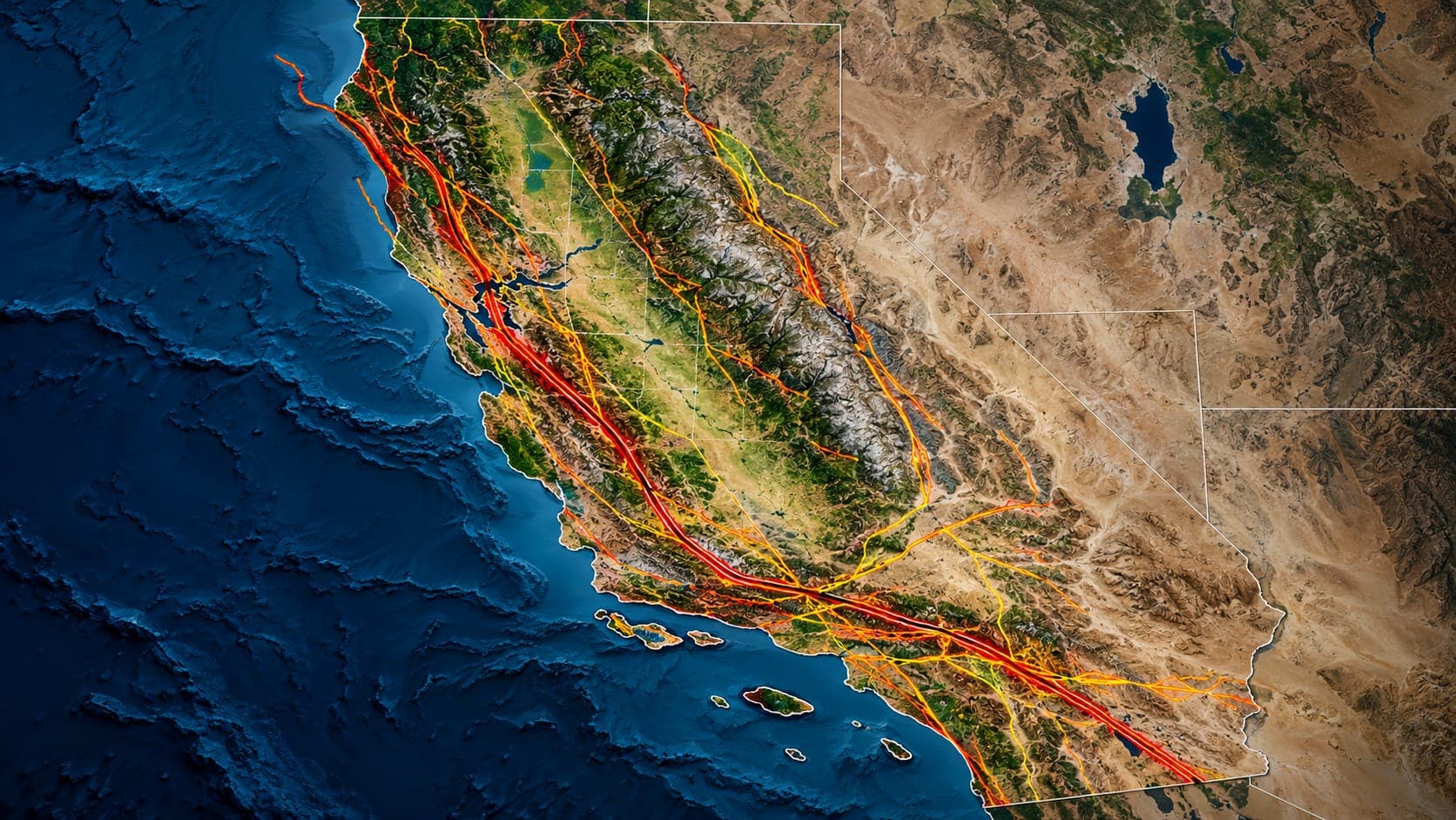
The San Andreas Fault gets most of the headlines, but it is only one of hundreds of active faults in California. Many of the state's most damaging recent earthquakes, including Northridge in 1994 and Ridgecrest in 2019, happened on other faults.
This article introduces the major earthquake fault lines in California beyond the San Andreas, grouped by region, and explains why some of the most important faults cannot be seen at the surface at all.
Quick answer
California has hundreds of active faults. Besides the San Andreas, major ones include the Hayward, Calaveras and Rodgers Creek faults in the Bay Area; the San Jacinto, Elsinore and Imperial faults in Southern California; the east-west Garlock Fault; the Newport-Inglewood Fault and buried blind thrusts such as the Puente Hills thrust under Los Angeles; and the faults of the Eastern California Shear Zone.
Recent earthquakes in CaliforniaA network, not a single line
The boundary between the Pacific and North American plates in California is not one clean crack. It is a broad zone, in places a few hundred kilometers wide, made up of many faults that share the motion. The San Andreas carries a large share, but faults to its east and west take up the rest. Some are strike-slip faults like the San Andreas, where the ground moves sideways. Others are thrust faults, where one block is pushed up over another, which are especially common in the Los Angeles region.
Each fault has its own rate of movement and earthquake history. A fault that moves slowly can still produce a damaging earthquake if it runs beneath a city.
San Francisco Bay Area faults
The Hayward Fault runs along the base of the East Bay hills through Richmond, Berkeley, Oakland, Hayward and Fremont, one of the most densely built-up fault zones in the country. Its last large earthquake, about magnitude 6.8, struck in 1868. Parts of the fault also creep slowly, which bends curbs and buildings along its path, including at the University of California, Berkeley stadium.
To the north, the Hayward Fault connects to the Rodgers Creek Fault through Santa Rosa. To the south and east, the Calaveras Fault branches off and runs toward Hollister; it produced the magnitude 6.2 Morgan Hill earthquake in 1984. Other Bay Area faults include the Concord-Green Valley and Greenville faults and the San Gregorio Fault along the coast. Many scientists consider the Hayward Fault the Bay Area's most likely source of the next damaging large earthquake.
Southern California strike-slip faults
Several large faults run roughly parallel to the San Andreas southwest of it:
- San Jacinto Fault: runs from the San Bernardino area toward the Mexican border and is one of the most seismically active faults in Southern California, with many moderate to large earthquakes in historic time.
- Elsinore Fault: runs through the Temecula area and the mountains east of San Diego toward Mexico. It has been relatively quiet historically but is capable of large earthquakes.
- Imperial Fault: in the Imperial Valley near the border; it produced the magnitude 6.9 El Centro earthquake of 1940.
- Newport-Inglewood Fault: runs along the coastal Los Angeles Basin from Beverly Hills toward Newport Beach. It caused the magnitude 6.4 Long Beach earthquake of 1933, which badly damaged schools and led to stronger school building laws.
The Garlock Fault
The Garlock Fault is unusual. It runs roughly east-west for about 250 kilometers along the northern edge of the Mojave Desert, from where it meets the San Andreas near the Tejon Pass area toward Death Valley. Unlike the San Andreas, it is left-lateral: looking across it, the other side moves to the left.
The Garlock helps separate the Mojave Desert block from the Sierra Nevada and Basin and Range to the north. It has not had a large historic earthquake, but geologic studies show it has produced large prehistoric ones. The 2019 Ridgecrest earthquakes triggered small slip on part of the Garlock Fault, which scientists watched closely.
Blind thrusts: faults you cannot see
Some of the most important faults under Los Angeles are blind thrust faults. They are buried beneath the surface and never break through to it, so they were not found by traditional mapping of surface fault lines. Instead, they lift and fold the ground above them over time, building hills.
The 1994 Northridge earthquake, magnitude 6.7, happened on a blind thrust beneath the San Fernando Valley and was one of the costliest earthquakes in U.S. history. The Puente Hills thrust runs beneath downtown Los Angeles and nearby communities; a related part of it is believed to have caused the magnitude 5.9 Whittier Narrows earthquake in 1987. Because blind thrusts lie directly under dense urban areas, they are a major part of the Los Angeles hazard even though no fault line shows on the ground.
Nearby surface-breaking thrust faults matter too. The 1971 San Fernando earthquake, about magnitude 6.6, ruptured to the surface at the foot of the San Gabriel Mountains.
Eastern California and the desert
East of the San Andreas, a band of faults called the Eastern California Shear Zone runs through the Mojave Desert and continues north along the Owens Valley, where it is often grouped with the Walker Lane. Together these faults carry a meaningful share of the plate motion.
This zone has been very active in recent decades, with the magnitude 7.3 Landers earthquake in 1992, the magnitude 7.1 Hector Mine earthquake in 1999, and the 2019 Ridgecrest sequence, which included a magnitude 6.4 foreshock followed by a magnitude 7.1 Mainshock. In 1872, a very large earthquake struck the Owens Valley. Far northern California also has faults related to the Cascadia Subduction Zone offshore.
How to learn about faults near you
The California Geological Survey's Fault Activity Map and the USGS Quaternary Fault and Fold Database show mapped faults statewide; our article on the San Andreas Fault map explains how to read them. Remember that shaking reaches far beyond any fault line, so nearly everyone in California should be prepared regardless of which fault is closest.
EQRadar does not draw fault lines, but the live map of California and the history search show where earthquakes have been recorded, which often traces out active faults.
Frequently asked questions
How many faults are there in California?
California has hundreds of known active faults, and many more older or minor faults. Some important faults are buried and were discovered only after they produced earthquakes, so no map is complete.
Which California fault is the most dangerous?
It depends on how you measure. The San Andreas can produce the largest earthquakes, but faults running directly under cities, such as the Hayward Fault and the blind thrusts beneath Los Angeles, could cause very high losses even with smaller earthquakes.
What is a blind thrust fault?
A blind thrust is a thrust fault that does not reach the ground surface. It can produce strong earthquakes, like the 1994 Northridge earthquake, but leaves no visible fault line, so it is harder to find and map.
Do earthquakes on one fault trigger others?
Sometimes. An earthquake changes stress on nearby faults, which can make additional earthquakes more or less likely. The 1992 Landers earthquake, for example, was followed by a large aftershock on a nearby fault and triggered small earthquakes far away.
Key takeaway
California's earthquake hazard comes from a whole network of faults, not just the San Andreas. The Hayward, San Jacinto, Newport-Inglewood, Garlock and Eastern California faults, along with hidden blind thrusts under Los Angeles, can all produce damaging earthquakes, so preparedness matters everywhere in the state.
Sources
- Fault Activity Map of California — California Geological Survey
- Faults — U.S. Geological Survey
- Earthquake Country Alliance — Earthquake Country Alliance