Chile Earthquake Today
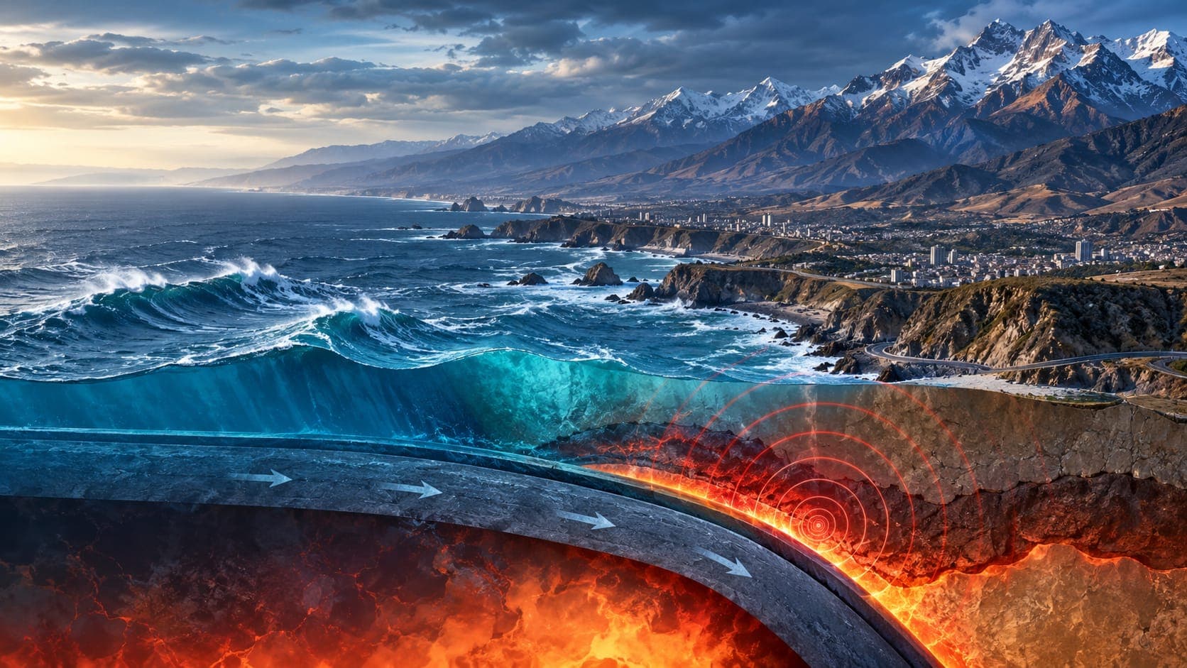
Chile runs for more than 4,000 kilometers along the edge of the Pacific, directly above one of the most productive earthquake zones on the planet. Small earthquakes are recorded there daily, and the country has experienced the largest earthquake ever measured.
Because this page is a reference article, it does not report today's earthquakes. It explains where to find official information, who issues tsunami warnings, how to read the reports, and how Chile's long history of great earthquakes shapes how it prepares.
Quick answer
To check for a Chile earthquake today, look first at the Centro Sismológico Nacional (CSN) of the University of Chile, the official source for earthquake reports. Tsunami warnings for Chile's coast come from SHOA, the Navy's hydrographic and oceanographic service, and evacuation is coordinated by SENAPRED. For international context, use the USGS, EMSC or the EQRadar live map of USGS data.
Open the live map of ChileWhere to check earthquakes in Chile
The Centro Sismológico Nacional, based at the University of Chile, runs the national seismic network and publishes a list of recent earthquakes with their location, depth, magnitude and local time, often as a distance from the nearest town. Chile's national disaster prevention and response service, SENAPRED, coordinates emergency response and can send alerts to mobile phones through the national emergency alert system. SHOA evaluates tsunami threats and issues warnings for the coast, including Easter Island and other territories.
Internationally, the U.S. Geological Survey (USGS) and the European-Mediterranean Seismological Centre (EMSC) locate moderate and larger earthquakes along Chile. You can follow USGS-reported events on the EQRadar live map of Chile, check official NOAA Pacific tsunami messages on the tsunami page, and see the sloping band of deeper earthquakes beneath the Andes in the 3D depth explorer. NOAA's messages are for international awareness; for Chilean coasts, SHOA and SENAPRED are the authorities.
How to read a Chilean earthquake report
Mainland Chile's clock is usually three or four hours behind UTC, depending on the season, and some regions and Easter Island differ, so convert UTC times from USGS and EMSC carefully. The CSN often reports a local Magnitude for smaller earthquakes and moment magnitude for larger ones, while USGS uses its own methods, so the numbers can differ a little. The first automatic values are often revised.
Check the Depth too. Earthquakes near the coast are often shallow and on the plate boundary, while those under the Andes, inland, can be 100 kilometers deep or more inside the sinking plate. Deep inland earthquakes are often widely felt but less damaging, and they do not cause tsunamis.
Why Chile has such large earthquakes
Off the coast, the Nazca plate sinks beneath the South American plate along the Peru–Chile Trench at several centimeters per year, one of the faster rates of plate convergence on Earth. This Subduction zone runs the length of the country, and the contact between the plates is long and wide. When a large section slips at once, it can produce magnitude 8 and even 9 earthquakes. Farther south, the Antarctic plate also sinks beneath South America.
The same process lifts the Andes and feeds Chile's many active volcanoes, which are monitored by the national geology and mining service, SERNAGEOMIN. Crustal faults also exist, such as the long Liquiñe-Ofqui fault zone in the south. Learn more in how plates move and our article on Ring of Fire earthquakes.
Notable earthquakes in Chile
On May 22, 1960, a magnitude 9.5 earthquake near Valdivia in southern Chile became the largest earthquake ever recorded by instruments. Its tsunami crossed the Pacific and caused deaths as far away as Hawaii and Japan. Our article on the biggest earthquake ever recorded tells that story in detail.
| Year | Earthquake | Magnitude | Notes |
|---|---|---|---|
| 1906 | Valparaíso | about 8.2 | Heavy damage in central Chile |
| 1939 | Chillán | about 7.8 | One of Chile's deadliest earthquakes |
| 1960 | Valdivia | about 9.5 | Largest instrumentally recorded earthquake; Pacific-wide tsunami |
| 2010 | Maule | about 8.8 | Strong shaking and a destructive tsunami in south-central Chile |
| 2014 | Iquique | about 8.2 | Northern Chile, after weeks of foreshocks |
| 2015 | Illapel | about 8.3 | Tsunami on the central coast |
Tsunamis, building codes and preparedness
The 2010 Maule earthquake showed both Chile's strengths and its lessons. Modern buildings designed to Chile's seismic code mostly performed well in very strong shaking, but the Tsunami that struck coastal towns within minutes caused many deaths, and official warnings that night were confusing. Since then, Chile has strengthened its warning procedures, coastal evacuation signs and regular drills.
For coastal residents, the key rule is simple: if shaking is strong enough to make it hard to stand, or lasts a long time, evacuate to high ground or outside the marked tsunami zone immediately, on foot if possible, without waiting for an official message. Stay away until authorities say the threat is over, because later waves can be larger. Our lesson on tsunami alert basics explains how warnings work.
If you felt an earthquake in Chile
Drop, Cover and Hold On during the shaking. When it stops, check for injuries, gas leaks and fire. On the coast, follow the evacuation rule above. Then check the CSN for details, SHOA for tsunami status, and SENAPRED and local authorities for instructions. After a large earthquake, aftershocks can be frequent and strong for weeks; see how long aftershocks last.
Frequently asked questions
Who issues tsunami warnings in Chile?
SHOA, the Chilean Navy's hydrographic and oceanographic service, evaluates tsunami threats and issues warnings, while SENAPRED coordinates evacuation and alerts with local authorities. After strong or long shaking on the coast, evacuate immediately without waiting for a message.
Why does Chile have so many very large earthquakes?
The Nazca plate sinks beneath South America quickly along a plate boundary that runs the whole length of the country. Large sections of that boundary can lock and then slip at once, producing magnitude 8 to 9 earthquakes.
Was the 1960 Chile earthquake really the largest ever?
Yes. At about magnitude 9.5, the 1960 Valdivia earthquake is the largest earthquake recorded since instruments began measuring earthquakes, more than a century ago.
Why does the CSN magnitude differ from the USGS magnitude?
The CSN and USGS use different networks and methods, and early values from both are often updated. Differences of a few tenths are normal. The CSN is Chile's official source.
Key takeaway
For a Chile earthquake today, check the CSN for the official report, SHOA for tsunami status and SENAPRED for instructions, then use USGS, EMSC or the EQRadar live map for context. On the coast, strong or long shaking means evacuate to high ground immediately.
Sources
- Centro Sismológico Nacional — Universidad de Chile
- Latest Earthquakes Map — U.S. Geological Survey
- European-Mediterranean Seismological Centre — EMSC
- Tsunami.gov — NOAA / U.S. National Weather Service